Distance Learning at AIU is enhanced by vast academic resources and innovative technologies build into the Virtual Campus: Hundreds of self-paced courses with video lectures and step by step lessons, thousands of optional assignments, 140,000 e-books, the Social Media & Networking platform allowing collaboration/chat/communications between students, and MYAIU develop students holistically in 11 areas beyond just academics.
The world is YOUR campus!”, that is the message of AIU’s month magazine Campus Mundi. Hear the voices and see the faces that make up AIU. Campus Mundi brings the world of AIU to you every months with inspirational stories, news and achievements by AIU members from around the world (students and staff are located in over 200 countries).
School of Science & Engineering
The Bachelor in Land Surveying program at AIU is designed for professionals seeking a flexible and comprehensive education in geomatics, mapping, and geospatial sciences. Our Land Surveying Bachelor’s Degree offers a dynamic curriculum that integrates theoretical knowledge with practical applications, preparing students for a successful career in land surveying and mapping. As part of AIU’s Geomatics and Land Surveying Program, students will explore key topics such as geodetic science, remote sensing, and spatial data analysis. This program aligns with the principles of Bachelor in Geodetic Engineering distance learning and AIU’s andragogy-driven education, ensuring a personalized learning experience that accommodates working professionals.
Begin Your Journey!
AIU’s Summer of Innovation and Growth gives you the ability to earn up to $5000 in tuition credit by completing free lessons and courses.
Whether you’re looking to acquire new skills, advance your career, or simply explore new interests, AIU is your gateway to a world of opportunities. With free access to 3400 lessons and hundreds of courses the ability to earn credits and earn certificates there’s no better time to start learning.
Join us today as a Guest Student and take the first step towards a brighter, more empowered future.
Explore. Learn. Achieve.
Important: Below is an example of the topics or areas you may develop and work on during your studies. By no means is it a complete or required list, as AIU programs do not follow a standardized curriculum. It is meant solely as a reference point and example. Want to learn more about the curriculum design at AIU?
Check here: Course and Curriculum
The Bachelor in Geodetic Engineering program at AIU covers a wide range of essential subjects to equip students with the skills needed for a successful career in surveying. Our curriculum includes Top Land Surveying Courses Online, ensuring accessibility and flexibility for learners worldwide. Core courses focus on fundamental and advanced topics such as Geodesy, Photogrammetry, Remote Sensing, GIS Applications, and Construction Surveying. Additionally, students will gain expertise in GPS and Land Surveying Degree concepts, learning to utilize cutting-edge technology for precise measurements and mapping. These courses meet Land Surveyor Education Requirements, preparing graduates for professional roles in geospatial analysis, infrastructure development, and environmental planning.
The orientation courses for the Bachelor in Land Surveying program provide a strong foundation in surveying principles, preparing students for advanced studies in Geodetic Engineering and mapping technologies. These introductory courses cover essential topics such as Fundamentals of Land Surveying, Basic Geodesy, and Boundary Mapping, ensuring students understand key concepts in land measurement and property delineation. Additionally, courses on Survey Equipment introduce students to the tools and technologies used in modern surveying, including total stations, GPS systems, and leveling instruments. This foundational knowledge is crucial for mastering advanced surveying techniques and real-world applications.
Research projects in the Bachelor in Land Surveying program allow students to apply theoretical knowledge to real-world challenges using advanced Land Surveying Technology Studies. Students can undertake projects such as Construction Surveying for infrastructure development, creating Topographic Maps for land planning, and conducting GPS Surveying for high-precision geospatial data collection. Additionally, Terrain Analysis projects help students assess landforms, elevation changes, and environmental factors affecting land use. These research initiatives enhance technical skills and prepare graduates for professional roles in geospatial engineering, mapping, and land development.
Publication – Students pursuing a Bachelor in Land Surveying at AIU have the opportunity to contribute to academic and industry discussions through student publications. These publications showcase research and innovations in land surveying, covering topics such as geographic information systems, advanced surveying technology, and the role of a professional land surveyor in modern infrastructure projects. Articles and research papers highlight advancements in engineering technology, precision mapping, and cadastral surveying, helping students build a strong academic portfolio. Publishing work in industry journals and AIU’s research platforms also supports career growth, providing valuable exposure for aspiring licensed land surveyors in the field.
The thesis defense for the Bachelor’s Degree in Land Surveying at AIU is a critical milestone where students demonstrate their expertise in construction surveying, land management, and land development. Candidates present research that applies remote sensing and geospatial technologies to solve real-world challenges, showcasing their ability to solve broadly defined technical problems in the field.
The defense emphasizes adherence to ethical and professional responsibilities, ensuring that future land surveyors uphold industry standards. AIU’s surveying degree aligns with global academic standards, including those set by the Natural Science Accreditation Commission, preparing graduates for professional success in land surveying and geodetic engineering.
The Bachelors in Land Surveying student experience at AIU is enriched by AI-driven education, offering a personalized and adaptive learning approach. Students gain hands-on expertise in global positioning systems, surveying and mapping, and surveying software, ensuring they stay ahead in the evolving geospatial industry. With a strong foundation in civil engineering principles, they learn to operate advanced surveying equipment while analyzing geospatial data for various applications. The curriculum also emphasizes critical skills such as small business management and the ability to communicate effectively, preparing students for leadership roles. AIU’s program aligns with professional standards, including those set by the National Council, ensuring that graduates earn a recognized science degree that meets industry demands.
At AIU, the Bachelor’s in Land Surveying program offers more than just academic excellence—it fosters a strong sense of community and professional development. As part of the applied science degree, students are guided to embrace professional responsibilities and are prepared to tackle the real-world challenges of land surveying. The curriculum includes hands-on projects such as topographic mapping and opportunities to conduct experiments, allowing students to apply their scientific knowledge in practical scenarios. With the support of the program coordinator, students are encouraged to develop their scientific judgment, building a solid foundation for their careers. Despite being an online program, AIU offers multiple avenues for connection and collaboration, bringing together students, faculty, and alumni through virtual platforms, symposiums, and other networking opportunities. This tight-knit community ensures students are not only prepared for their undergraduate degree but are also equipped to excel in the land surveying profession.
The Bachelor’s in Land Surveying program at AIU is equipped with a wealth of academic resources to ensure students are well-prepared for the challenges of the profession. The curriculum emphasizes developing skills to interpret data and understand coordinate systems, enabling students to effectively analyze and present geospatial information. Students will gain expertise in geographic information systems (GIS), a critical tool for modern land surveying and mapping. By learning to analyze risk and address complex surveying issues in various societal contexts, students will be ready to function effectively in the field. AIU’s resources and support help students enrolled in the program gain the knowledge needed to successfully pursue a career, with many graduates receiving multiple job offers upon completion. The program fosters a strong foundation in both technical and professional skills, ensuring graduates are prepared for immediate success in the industry.
Complete assignments online or offline at your convenience with 24/7 access to distance learning through AIU’s Virtual Campus. Step by Step guides including videos, tutorials, live webinars and examples for each course. All materials can be access on all web browsers as well as via AIU's Mobile App which brings all the features of the Virtual Camus to your Mobile Device.
MyAIU’s primary goal is to go beyond Academics, it looks to guide students through 11 elements that are key to living life optimally in all aspects. By identifying and reflecting on these key areas, an opportunity arises to holistically address them, through positive change, habits, reinforcement and tools to keep students on their chosen path.
The students have the opportunity to produce, edit and host their own show reaching a worldwide audience, the AIU community and giving notice of their expertise/passion in the subject. AIUTV & AIU Radio allow students to explore new ways to communicate, develop a platform and form potential collaboration with likeminded individuals.
AIU Campus Mundi is a monthly magazine that gathers the most notable news and information about the university and its members in one convenient place. The magazine allows our community to be well informed, involved and keep in tough regardless of their geographic location. AIU Campus Mundi publishes, news, research, events, awards, academic achievements.
Each year AIU organizes graduation ceremonies where the students can assist and share their experiences with fellow students and academic members Participation in the ceremony is optional, the day’s events include conferences, research presentations, group meetings, networking, lunch and formal dinner.
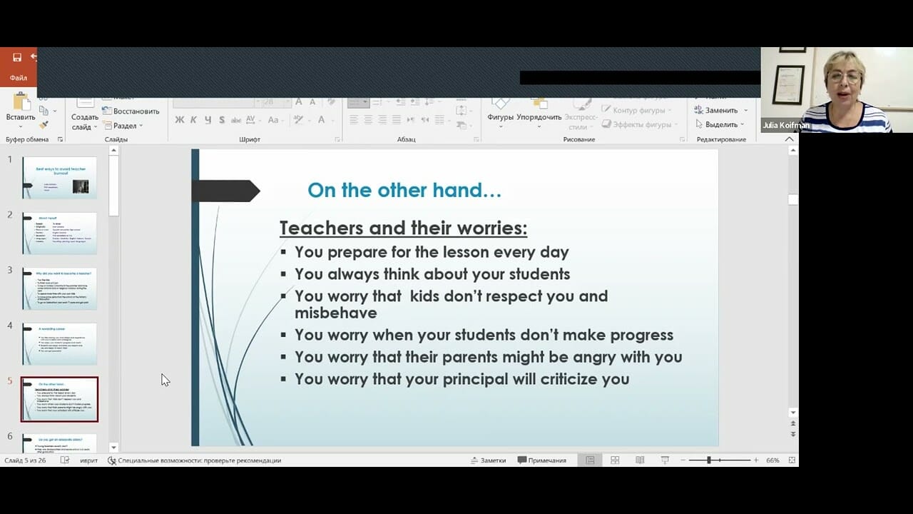
The Bachelor’s in Land Surveying program at AIU offers students the unique opportunity to participate in international symposiums, where they can engage with experts, peers, and professionals in the field of surveying. These symposiums cover a wide range of technical topics and real-world challenges, providing students with a platform for applying knowledge in areas relevant to surveying.
At AIU, the Bachelor of Science in Land Surveying program offers the unique advantage of two live classes each day, allowing students to engage with their coursework in real-time. These sessions focus on key topics such as geographic information systems (GIS) and the science of mapping the earth’s surface, providing students with the tools they need to succeed in the field. Through live interactions, students have the opportunity to test hypotheses, apply knowledge, and draw conclusions about complex surveying scenarios.
The program’s applied science approach ensures that students gain practical experience while also mastering the required courses to meet industry standards. This immersive learning environment prepares students for a wide range of employment opportunities upon graduation, ensuring they are ready to enter the workforce with confidence. Most students benefit from this hands-on approach, equipping them to excel in land surveying and related professions.
AIU Live Classes Examples on Land Surveying:
The Bachelors in Land Surveying program at AIU encourages students to engage in special projects, research publications, open courses, and co-authoring opportunities, allowing them to apply their knowledge in geospatial information technology and land surveying. These projects help students establish goals, develop their problem-solving skills, and work on complex engineering challenges, such as squares adjustment and other technical aspects of land measurement. Students are guided through the process of conducting research and publishing findings, ensuring they can meet desired objectives and meet deadlines. Through collaboration with faculty and peers, students contribute to science and advance their understanding of the surveying field. This hands-on experience provides students with a competitive edge in the industry and prepares them for professional success while enhancing their knowledge in geospatial information and related technologies.
The Career Center at AIU plays a pivotal role in supporting students pursuing the Bachelor’s in Land Surveying by offering valuable resources for career development. The center helps students explore various career paths, from becoming professional surveyors to pursuing opportunities in construction and land development. With access to job listings, internships, and industry connections, students can apply the skills they develop throughout the program, particularly through specialized courses and the comprehensive curriculum that covers surveying techniques, geospatial data analysis, and land management. The Career Center also provides guidance on resume building, interview preparation, and professional networking, ensuring graduates are well-equipped to enter the workforce and thrive in their careers.
Graduates with a Bachelor’s in Land Surveying from AIU are prepared for a wide range of job roles in the surveying and geospatial fields. Career opportunities include positions as Land Surveyors, where they conduct land measurements, create topographic maps, and assess land for development projects. Other roles include Geospatial Analysts, responsible for analyzing and interpreting geographic data, and Construction Surveyors, who support building projects by ensuring accurate measurements for construction and design.
Graduates may also pursue roles in Urban Planning, helping to manage land use and zoning, or work as Cadastral Surveyors, focusing on land boundaries and legal documentation. With expertise in GIS and remote sensing, some graduates may become Mapping Specialists, working in industries ranging from environmental management to telecommunications. This degree provides the versatility to enter multiple industries, ensuring a wide array of exciting career options.
In the Bachelor’s in Land Surveying program at AIU, students gain hands-on experience with a variety of essential surveying tools that are fundamental to the profession. These tools include:
These tools help students to conduct precise measurements, analyze geographic data, and create accurate mapping products, essential for successful careers in land surveying and geospatial sciences.
Graduates with a Bachelor’s in Land Surveying from AIU can benefit from membership in several professional associations that offer networking, resources, and career advancement opportunities. Some key organizations include:
Membership in these associations provides valuable industry connections, professional development, and access to resources that enhance a surveyor’s career prospects.
To be eligible for admission to the Bachelor’s in Land Surveying program at AIU, students must have successfully completed their High School Diploma, GED, or an equivalent qualification from an accredited institution. AIU seeks students who have a strong academic foundation and a genuine interest in pursuing a career in land surveying, geospatial sciences, or related fields. Applicants should demonstrate readiness for university-level coursework and have the necessary skills in mathematics, science, and technology to excel in the program. With this solid educational background, students are equipped to thrive in AIU’s comprehensive, hands-on curriculum, which prepares them for professional success in land surveying.
These straightforward steps ensure a smooth and efficient application process as you begin your journey towards a career in land surveying.
AIU offers various financial support options and scholarships to help students pursuing the Bachelor’s in Land Surveying program manage the cost of their education. Scholarships are available based on academic merit, financial need, and other criteria, allowing students to reduce their tuition fees. AIU also provides flexible payment plans to ensure that financial barriers do not hinder students’ educational goals. Additionally, students are encouraged to explore external funding opportunities and government-sponsored financial aid programs. AIU’s financial support team is committed to helping students navigate these options and find the best solutions to finance their education, ensuring they can focus on their studies and future careers.
The cost per year for pursuing a Bachelor’s in Land Surveying at AIU varies depending on the student’s specific enrollment status, location, and any available financial aid or scholarships. AIU offers flexible payment plans to accommodate different financial needs, and students can consult with the admissions or financial aid office for personalized cost estimates based on their circumstances. Additionally, AIU provides access to various financial support options, including scholarships and external funding opportunities, to help reduce the overall cost of education. For the most accurate and up-to-date information, prospective students are encouraged to contact the admissions office directly.
Job prospects after completing a degree in Land Surveying are generally strong. Graduates can work in various fields such as construction, civil engineering, real estate, urban planning, and government agencies. Common roles include land surveyor, GIS technician, mapping specialist, or survey manager. With experience, opportunities for advancement into leadership or project management positions are available. Demand for surveyors is steady, particularly in areas with ongoing infrastructure development. Additionally, those with expertise in specialized areas like environmental or geodetic surveying may find further opportunities.
These subjects prepare students for practical surveying tasks and industry standards.
Land surveying uses a variety of tools and technologies, including:
Land surveying is crucial to construction and development projects as it provides accurate measurements and data for designing and planning. Surveyors establish property boundaries, topography, and land contours, ensuring that projects align with legal requirements and environmental considerations. They also assist in site preparation, layout design, and ensuring proper alignment of structures. Surveying ensures safety, efficiency, and compliance, reducing errors and costly delays during construction.
To enroll in a Bachelor in Land Surveying program, typical qualifications include:
These requirements may vary depending on the university or region.
Home | Online Courses | Available Courses | Virtual Campus | Career Center | Available Positions | Ask Career Coach | The Job Interview | Resume Writing | Accreditation | Areas of Study | Bachelor Degree Programs | Masters Degree Programs | Doctoral Degree Programs | Course & Curriculum | Human Rights | Online Library | Representations | Student Publication | Sponsors | General Information | Mission & Vision | School of Business and Economics | School of Science and Engineering | School of Social and Human Studies | Media Center | Admission Requirements | Apply Online | Tuition | Faculty & Staff | Distance Learning Overview | Student Testimonials | AIU Blogs | Register for Program | Privacy Policy | FAQ